Following on the post below, here is an attempt at making a map of military posts in French Indochina in World War II.

On the map page you can switch to “terrain” view by clicking on the dropdown menu in the upper right-hand corner of the screen.
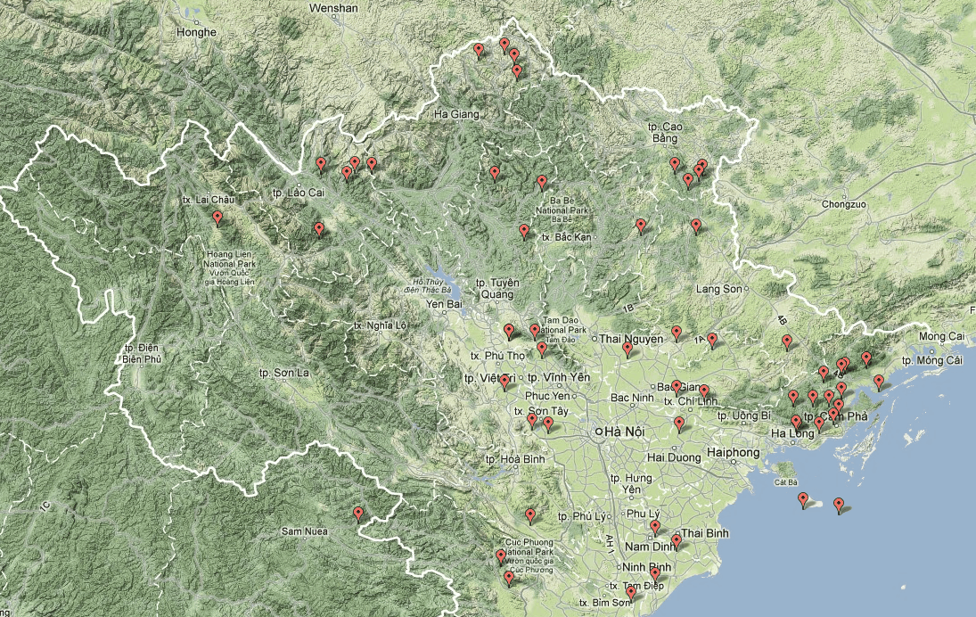
It is interesting to do so as it makes it clear that in Tonkin, military posts were placed around the edges of the Red River Delta, and along the borders. There was a particularly numerous group of posts near the northeastern coast. I would be interested in knowing what the reason for that was (expecting a naval attack?).
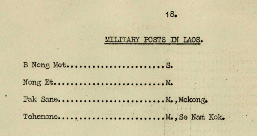
Another point that I find interesting is that there were only four military posts in Laos. . . Also, we can see again here that the borders were different then.


