I have absolutely no desire to get involved in the Trường Sa/Hoàng Sa debate. Why? Because I’m an historian and as an historian I can’t stand listening to the historians in this debate (on both sides) talk about “sovereignty” (chủ quyền/主權) prior to the twentieth century.
“Sovereignty” is a WESTERN concept. IT DID NOT EXIST IN ASIA PRIOR TO THE 20TH CENTURY. If it had existed, then why did the Japanese have to create a new term – “shuken” (chủ quyền/主權) – to translate the Western word, “sovereignty”???
Prior to the 20th century, concepts of borders and the control of territory were more vague in Asia than they were in the West. It is only through contact with the West that this changed. The classic academic treatment of this topic is Thongchai Winichakul’s Siam Mapped, which demonstrates how Siamese elites only came to view their land as a clearly-defined territory and to map it (in the Western sense) after the Siamese were forced to defend their kingdom from the threat of Western conquest.
The Siamese learned to “map Siam” in a Western way in order to demonstrate where the territorial boundaries of the kingdom were (as these were issues which the Siamese had not bothered with before) so that the British and French could be kept at a distance.
The story of how Vietnam came to be “mapped” has yet to be told, but there is plenty of material to determine how this happened.
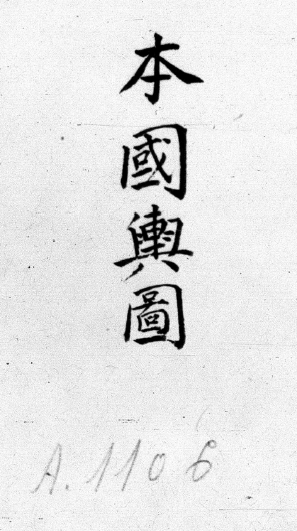
What is clear is that ideas about mapping in Vietnam gradually started to conform to Western standards in the late nineteenth and early twentieth centuries. I was just looking at a work called the Bản quốc dư đồ. This map is undated, and there is no information about who created it, but I would argue that it was probably created in the late 19th or early 20th centuries.

Why do I think this way? First, because it contains the above image of mainland Southeast Asia. I don’t think that Vietnamese ever obtained such knowledge of this region themselves (this map even has the Malay Peninsula and Sumatra on it). Instead, it had to have come from others, such as the French (or maybe some map created by a Chinese or Japanese reformer, which in turn would have been new because of their contact with Western mapping ideas), and yet this map in its style (it doesn’t clearly indicate borders, for instance) more closely resembles a traditional Vietnamese map than a nineteenth-century Western map.
Also, on this map Vietnam is referred to as “Vietnam, that is, An Nam.” That terminology strikes me as post-French contact. If it was a map which predated French contact then I think it should say Đại Nam or Thiên Nam. Also, it has Jianpusai (柬埔塞, how do we write this in quốc ngữ?) rather than Cao Miên (高棉) for Cambodia. That is also a more modern term. (Did Vietnamese ever use it much?)
The following image is also interesting. It is a map of the “entire kingdom.” It is not how Westerners arrange maps. In this map the north is to the right and the south is to the left. However, it is rare to find a map of the entire kingdom in pre-twentieth-century Vietnamese geographies. And I do not know of any traditional geography which places the kingdom in the larger region like the image above does.

In other words, this map looks like a kind of transitional map between a traditional map and one which is based on Western principles.
Having said all that, there is yet one more thing about this image of the “entire kingdom” which is interesting. . . Out in the sea this map has two circles. One of those circles is labeled “Yellow Sand Islets” (黃沙渚, Hoàng Sa [what is 渚 in quốc ngữ?]) and the other is labeled the “Vast Reservoir” (洪潭, Hồng Đầm).
So does this map show that “Vietnam” had “sovereignty” over the Hoàng Sa islands? Rather than answer that question directly, let’s look at some of the other parts of the map.
At the top of the map there are various names for places which are today in Laos, and in the upper left is the term for Siam. There is no line indicating that these areas were in separate territories. Does this mean that “Vietnam” had “sovereignty” over Laos and Siam?
Maybe those names are just there to put “Vietnam” into geographical perspective. If that is the case, then perhaps the Hoàng Sa islands are there for the same reason.
The only place on this map where we can get a sense of a border is on the right-hand side. There we find some border passes. These are border passes between “Vietnam” and “China,” though there are no names here for “China” or “Guangdong” or any other such places to indicate what is on the other side of those border passes.
So what is my point? My point is that concepts of space and borders and political control were different in the past. They were much more vague than they are today.
Historians can seek to understand how people in the past understood these concepts differently, but they should never try to find modern ideas (like sovereignty) in the past where they did not exist.


This Post Has 2 Comments
Yeah, I found the historical basis arguments for sovereignty over the islands to be embellishments. As a pragmatist, I find that political, economic, and military powers and pressures will really determine the outcome, not historical.
There is a political scientist, David Kang, who has a great passage in his recent book, East Asia Before the West: “. . . many of the disputes over uninhabited rocks and maritime boundaries are a result of the modern, Westphalian system that states now unquestioningly accept – after all, five hundred years ago, nobody cared about the uninhabited rocks in the middle of the ocean except the fishermen who tried to avoid wrecking upon them. Thus, working backward into time to see what ancient kings thought of these islands is useless, because they did not think anything about them at the time. The rulers of historical states in East Asia were concerned with other territorial and border issues, to be sure, as this book will show. But the contemporary preoccupation in many East Asian countries over historical issues is really a modern political matter, as leaders and peoples attempt to craft a glorious identity that celebrates and elevates their particular country.” (pg. 7)
I’m not sure which “uninhabited rocks” Kang was thinking about here. He may have had some of the islands that Japan disputes with China and Taiwan, but this passage applies well to the Truong Sa and Hoang Sa.